Unraveling the Developments in Khan Yunis: Occupation Forces Advance Under Scrutiny

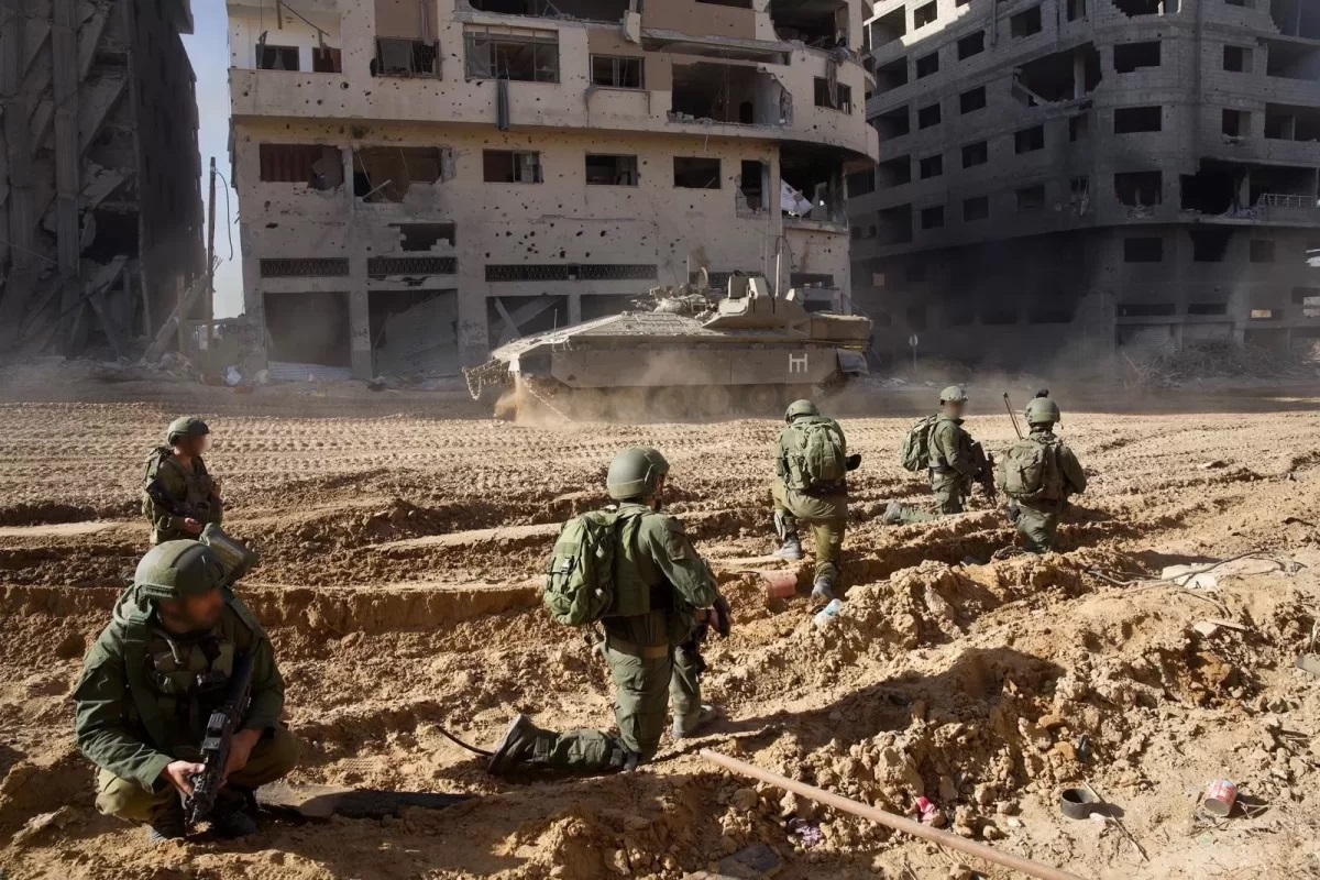
Watan-A report from the ‘Ikad’ platform, specialized in fact-checking news and open sources, sheds light on the developments of the war in the city of Khan Yunis, which has emerged as a new battleground. The report highlights the attempts of the occupation army to encircle the city.
Published through its official ‘X’ account, the Ikad report addresses questions such as: What is happening in Khan Yunis? And, how far have the occupation forces advanced there?
The platform, in monitoring the course of battles in Gaza, utilized a map shared by the ‘War Mapper’ account, specializing in war maps, on December 5th. The map illustrates the locations of clashes up to 21:00 GMT on December 4th.
#جيونيوز🗺️| في قلب الحرب التي زاد الاحتلال من شدتها بعد الهدنة، تتجسد مدينة “خان يونس” كمسرح جديد للمعارك حيث يحاول تطويق المدينة.
📌فماذا يحدث في خان يونس؟ وإلى أين وصلت قوات الاحتلال فيها؟ pic.twitter.com/QhYvDbe6s6
— Eekad – إيكاد (@EekadFacts) December 8, 2023
The map revealed the actual penetration of occupation forces into Khan Yunis, reaching Salah al-Din Street. But how did the incursion begin?
According to the platform, with the end of the ceasefire on December 1st, the occupation army announced its ground operations in areas 162, 36, and 252 of Gaza. These numbers correspond to locations within Khan Yunis, as indicated by a recently published occupation division map.
The entry of Israeli tanks into Deir al-Balah
Further tracking developments in Khan Yunis, the report found that photojournalist Muath Azayza mentioned Israeli tanks cutting off the road between Khan Yunis and Deir al-Balah. On the following morning, December 2nd, the Israeli army stated that its forces had attacked 400 targets in Khan Yunis.
The report also noted that on the night of December 1st, the Israeli naval forces conducted an operation in the ports of Khan Yunis and Deir al-Balah.
A video, shared by journalist Fuad Abu Khamash on December 2nd, showed Israeli tanks entering Deir al-Balah from the west of Salah al-Din Street at the former Abu Holi checkpoint. This checkpoint historically separated the areas of Khan Yunis and the southern Gaza Strip from the northern part.
Satellite images captured on December 2nd and published by The New York Times displayed the positioning of Israeli vehicles at the Abu Holi checkpoint. Calculating the distance from the location of the Israeli forces, ‘Ikad’ found that they were approximately 6 kilometers away from the city of Khan Yunis.
📌مقطع الفيديو pic.twitter.com/22jZlyMJhv
— Eekad – إيكاد (@EekadFacts) December 8, 2023
The Israeli incursion
On December 3rd, Palestinian activist Saleh Al-Jaafaraoui shared a photograph from the Mills Junction on Salah al-Din Street, revealing an Israeli tank reaching that location.
The significance of Salah al-Din Street, according to the source, lies in its connection between the cities of Deir al-Balah and Khan Yunis. It is intersected by a road from the east, exiting from the Kfar Darom site within the occupied territories.
According to accounts from journalists in Gaza, the occupation is penetrating into the areas of Al-Qarara, Bani Suhaila, and Absan in Khan Yunis. Journalist Isma’il Abu Omar also mentioned receiving pleas from residents trapped in their homes in Bani Suhaila, besieged by Israeli military vehicles.
🔻وحسب شهادات صحفيين في غزة، فإن الاحتلال يتوغل إلى مناطق القرارة وبني سهيلا وعبسان في خان يونس.
🔻كما ذكر الصحفي إسماعيل أبو عمر أن هناك مناشدات تصلهم من مواطنين محاصرين في منازلهم ببني سهيلا من قبل آليات الاحتلال. pic.twitter.com/B5kJRzFVyV
— Eekad – إيكاد (@EekadFacts) December 8, 2023
Israeli Attempt to Encircle the City
In an analysis of these movements, journalist Tareq Al-Farra stated that the occupation is attempting to encircle the city from the west, through the sea, and also from the east, near Bani Suhaila, leaving the southern area for displacement.
Based on this information, the platform concluded that the occupation is advancing towards Khan Yunis from multiple directions to create a sort of perimeter around it, with the exception of the southern part of the city, which is likely to remain an avenue for forcing people to leave their homes and migrate southward.


